Warning – lots of photos ahead!
The day began with the end of the RM Williams Way, through gently rolling pasture land, with a distant promise of what was to come.


There are dozens of these abandoned stone houses scattered across the landscape, who knows how old they might be.

Rolling through Hawker and further north, the first reaches of the Ranges came into view.


The first stop was Arkaroo Rock, an aboriginal art site just outside the National Park. Some sights from the quick 3km hike:


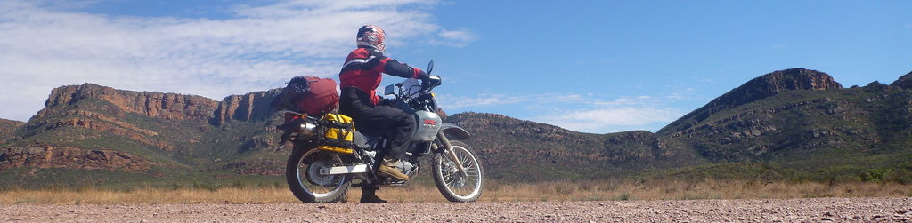
Then it was time to enter the Flinders Ranges National Park itself.

The route I chose did miss a lot of the major sights, such as Wilpena Pound – a huge natural amphitheatre created by the intersection of two ranges, but I was short for time as this was already a significant detour off my original route – but very much worth it.

I chose to ride through the Bunyeroo Valley and Brachina Gorge, to get an overview of what the area was like. This route started by meandering through rolling hills and wide, sweeping bends.


Before climbing dramatically onto a feature aptly named Razorback Ridge.


Then the road dropped into Bunyeroo Gorge.


Now heading north, the road ran parallel to the major range for a while, providing some great scenery.


Then once again, we dropped into a defile, this time Brachina Gorge, where the geological forces that had shaped these 500 million year old rock formations were evident.


Once through the gorge and out the far side of the National Park, I got a taste of the South Australian Outback, albeit with a beautiful mountain range running on one side.


I hadn’t had quite enough of the area yet, so as I turned back southwards to rejoin my planned route, I took a scenic drive that cut back through the ranges.


Then rejoined the long and lonely highways that connect the rural areas. It’s hard to describe the scale of this land until you’ve experienced it for yourself, mile after mile rolling under your wheels in an ever-changing and yet ever-familiar movie reel.


The road wound it’s way down towards Port Augusta.


Where the only thing of interest, aside from strange smells and stranger people, was this sign:

I don’t think there’s a road-sign anywhere else on earth that (quite seriously) lists two places that are so far apart from each other.
As there were a few hours of daylight left, I decided to get a head-start on the Eyre Peninsula, which turned out to be a good warm-up for the Nullarbor – dead straight, no views, and no reason to travel along it save for the sake of the journey.

Oh, and the delightfully named town of Iron Knob.

Just before dusk I pulled in to my night stop at Kimba, which claims to be halfway across Australia.

Where there’s the unique attraction of the “Big Galah”. I don’t know why, but it’s part of the Australian psyche to assume that giant versions of ordinary things automatically become tourist attractions – no matter how crap they may be.

I’m sneakily camping under a row of tin sheds on the edge of the sporting fields, to escape a storm that’s rolling in – a welcome relief, given that it hit 38 degrees up in the Ranges earlier today!